
Welcome to Luna Geospatial
We are a team of Open Source GIS experts that provide consulting, support, software development, and cloud-based hosting services to a worldwide clientele.
Discover LunaMap.io
LunaMap.io is your go-to platform for managing and visualizing your geospatial data. With powerful tools and an intuitive interface, you can streamline your workflows and make informed decisions.
Learn More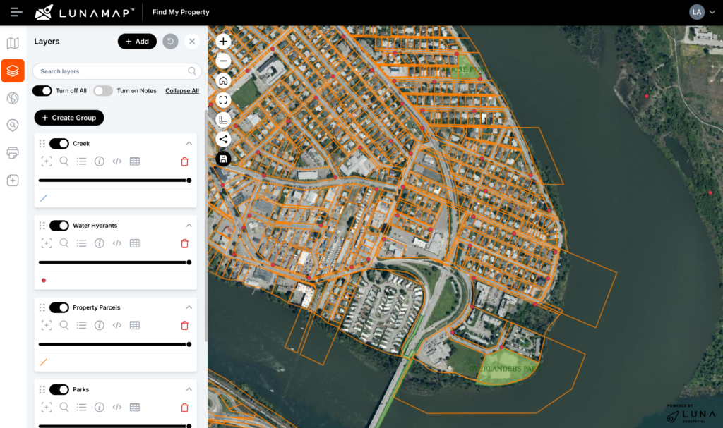
Experts in Open Source GIS
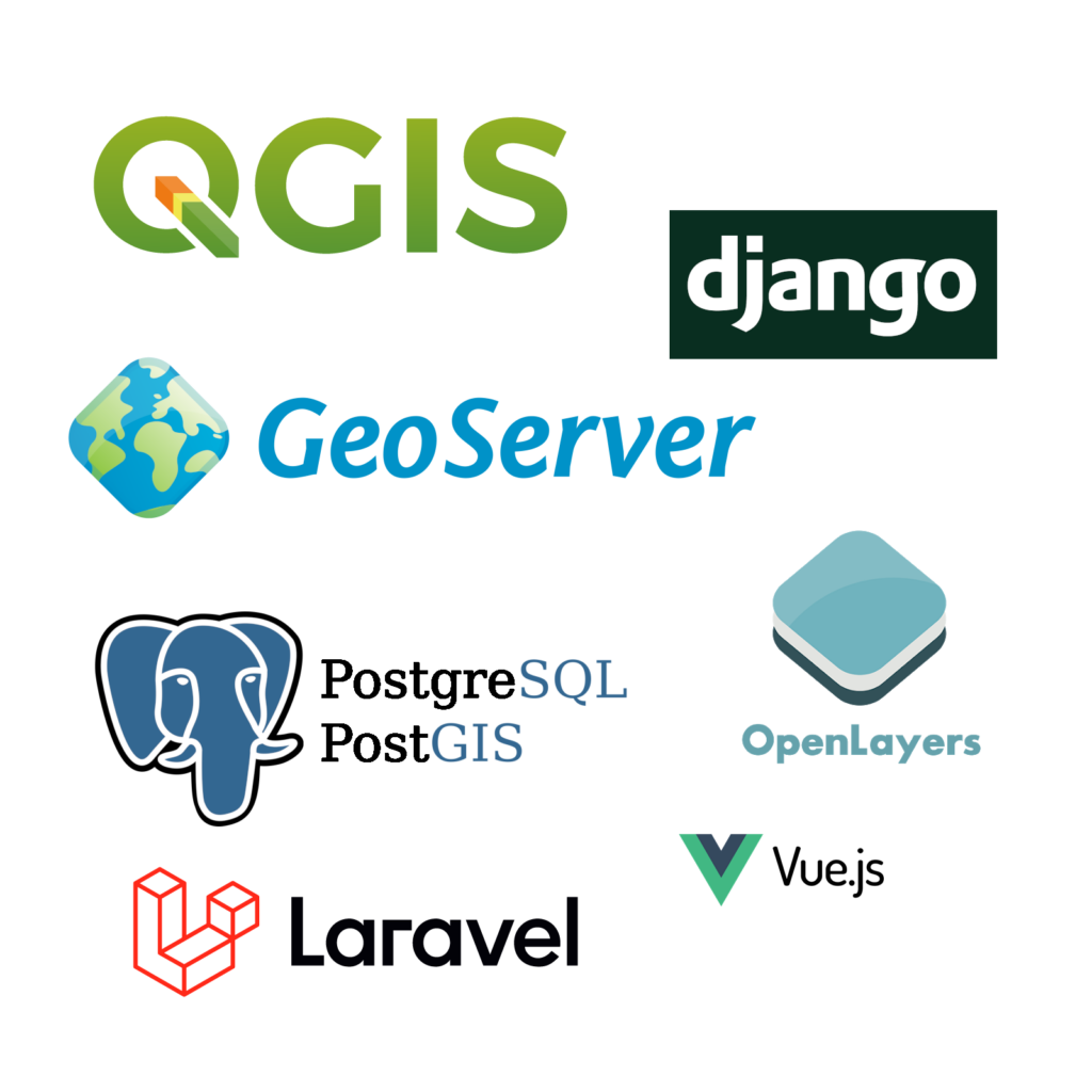
Our primary objective is to help companies and organizations migrate to open source GIS. We develop with and support a number of different open source technologies. Specifically, we love working with:
- Databases such as PostgreSQL & PostGIS, MySQL, SQLite, and Geopackage.
- Desktop GIS software such as QGIS, GDAL, GRASS, and SAGA GIS.
- GIS servers such as Geoserver and MapServer.
- Web frameworks and libraries such as GeoDjango, Laravel, WordPress, Bootstrap, jQuery, Spring, React, Angular, VueJS, etc.
- Programming languages such as Python, PHP, Java, and more.
Our Products and Services
GIS Consulting
We help clients leverage open source GIS with customized solutions for QGIS, PostGIS, Geoserver, and more.
Software Development
We build custom webGIS and data-driven applications using modern web frameworks.
LunaCORE
LunaCORE is a fully managed GIS server-as-a-service that runs PostgreSQL, PostGIS, Geoserver, and more.
LunaMap
LunaMap is cloud-native enterprise webGIS developed by our team to simplify sharing GIS data on the web.
PostGIS Hosting
Through LunaCORE, we offer a hosted instance of PostGIS, the spatial extension for PostgreSQL.
Training and Workshops
LunaGeo hosts virtual and live training and workshops throughout the year on various open source GIS software.
Private Training
Our private training sessions are perfect for businesses and organizations migrating to open source GIS.

Webinar
Multiuser Editing with QGIS and PostGIS in an Enterprise Environment
Wednesday, May 31, 2023


Open Source GIS Support
LunaGeo offers prepaid and dedicated support packages for a number of open source GIS software, including PostgreSQL, PostGIS, Geoserver, QGIS, PGAdmin4, and more.
Support ServicesHow can we help?
Contact us today to schedule a free consultation with a member of our team.