
The Open Source GIS Tribune - March 2022

About Luna Geospatial
We are a London, Ontario, based consulting company specializing in open source GIS and custom software development. Cliff Patterson, PhD, is the founder and CEO and has worked with open source GIS for over a decade in academia, archaeology, conservation, government, and the nonprofit sector. Backed by a talented team of GIS/RS experts and software engineers, LunaGeo offers small and medium-sized organizations cost effective GIS solutions for desktop, web, and mobile. We offer custom GIS servers, webGIS, and dashboards backed by professional support and training. If you need a geospatial partner, we should talk.
QGIS is 20 years old!
When evaluating open source software, the factors to consider most are maturity, the size of the development community, and update and bug fix frequency. QGIS (formerly Quantum GIS) is one of the most successful pieces of open source software today with an active and engaged steering committee, an international team of developers, and a vast user community in various sectors, including academia, NGOs, government, and business. In mid-February, 2002, Gary Sherman (@shermange) wrote the first lines of code and since then, the project has grown from a mere 2,173 lines of code to 2.4 million. It is incredible what we can accomplish when we work together. Happy birthday, QGIS!
Upcoming Webinars
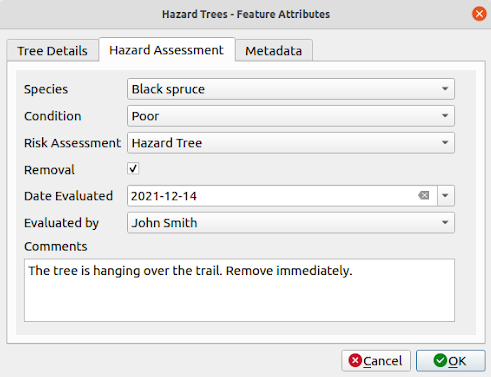
Create custom attribute forms in QGIS
Thursday, March 10th, 2022, at 2 pm EST via Zoom
Custom attribute forms are a hidden treasure of QGIS 3.x. Users can add checkboxes, dropdown menus, radio buttons, and even conditional logic to the popup attribute form. In this webinar, participants will learn how to use the drag and drop designer to add various widgets, constraints, default values, and tabs to attribute forms. Further, we will show how forms can be saved as part of the default layer style and used by all users within an organization.
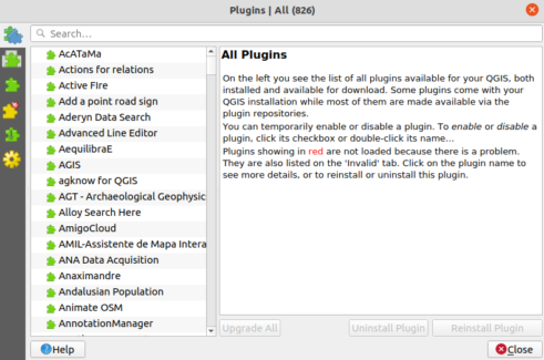
10 Great Plugins for QGIS 3.x
Thursday, March 24th, 2022, at 2 pm EDT via Zoom
QGIS offers the ability to develop and share custom plugins. These tools are easily accessible in QGIS and either offer solutions for specific tasks or offer whole suites of tools for specific sectors (e.g. forestry, agriculture, archaeology). With over 400 plugins currently available for QGIS 3.x, the choices seem endless. In this webinar, we will review 10 of the most popular plugins.
Spatial SQL isn’t Scary
Thursday, April 7th, 2022, at 2 pm EDT via Zoom
Spatial SQL offers the ability to work with vector- and raster-based geospatial data using the lingua franca of the database world, Structured Markup Language (SQL). When combining a relational database management system (RDBMS) like PostgreSQL with PostGIS, its spatial extension, users have the ability to perform a seemingly endless list of spatial functions – as one prominent developer likes to say, it is literally a “GIS in a box.” Geared for introductory users, this webinar will introduce participants to basic SQL queries, some common spatial queries using PostGIS, and how this technology is incorporated into QGIS.
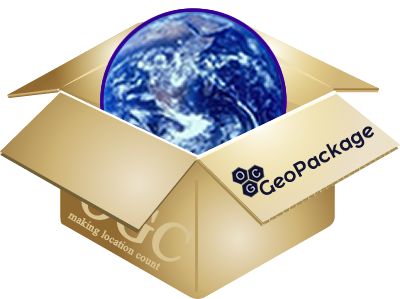
Geopackage and QGIS
Thursday, April 21st, 2022, at 2 pm EDT via Zoom
Geopackage is an OGC-compliant open file format for geospatial data that allows users to store data in a single file. As a file-based database built with SQLite, Geopackage stores data in a single file along with QGIS project files and default symbology. The unique aspect of Geopackage is that one can add both raster and vector data to it, making it the perfect solution to store and share project data. This webinar will discuss Geopackage specifications and show how it can be used within the QGIS environment to store and analyze geospatial data.
Upcoming Training
Introduction to QGIS
Instructor: Cliff Patterson, PhD
Price: $199.99 CAD per person
Registration Deadline: March 18th, 2022
Schedule
Session 1 Friday, March 25th, 2022, from 10 am–3 pm EDT via Zoom
Session 2 Saturday, March 26th, 2022, from 10 am–3 pm EDT via Zoom
Q&A Session Thursday, March 31, 2022, from 2–3 pm EDT via Zoom
Note: Participants can attend either of the two sessions and the followup Q&A session. Two 15-minute and one 30-minute break will be provided throughout the training session.
Course Overview
QGIS is a powerful open-source desktop GIS application that runs on Windows, Linux, and Mac. This introductory course is designed for someone who has limited to no experience in GIS. The course covers basic theoretical concepts in GIS, the application layout, common tools, and analytical methods. Participants will gain an overall understanding of GIS, how to conduct basic analysis, and how to make a map layout.
Questions/Comments?
We would love to hear from you at contact@lunageo.com or call us at (+1) 226-582-3640.