
Tutorials
Learn the basics of QGIS, PostGIS, and Geoserver with our growing list of free tutorials
Filters
-

PostgreSQL Trigger Functions
QGIS, PostgreSQL, PostGIS
PostgreSQL trigger functions can be used to execute predefined routines on database objects. For example, trigger functions are often used to populate metadata fields automatically, such as a created_by field that requires the username of the user who created the row. With PostGIS, trigger functions can also be used to execute spatial functions, such as st_area…
-

Data Auditing in PostgreSQL
PostgreSQL, PostGIS
Data auditing in PostgreSQL is a way to track changes on database tables by logging all actions (CREATE, INSERT, UPDATE, DELETE) to another table. In PostgreSQL, auditing tables and the associated trigger functions can be created in many ways and there are also extensions that can be used for auditing. The method presented in this…
-

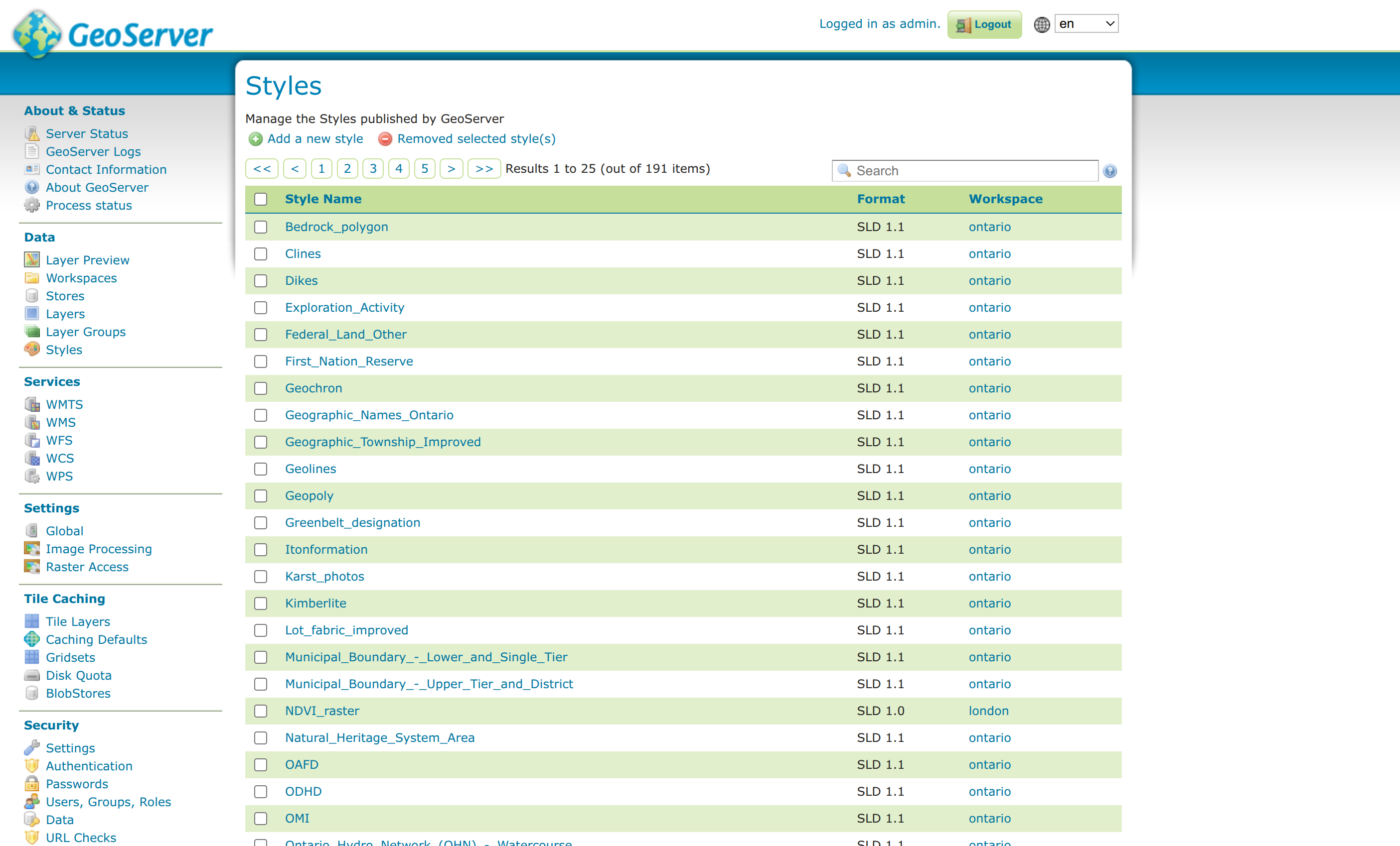
The Geoserver Data Structure
Geoserver
The tutorial explains the Geoserver data structure. Geoserver organizes spatial data through a hierarchy of components: workspaces, stores, layers, layer groups, and styles. Workspaces help group related data (like boundaries or imagery) and can be isolated for targeted WMS requests. Stores connect Geoserver to specific data sources—such as shapefiles, rasters, PostGIS schemas, or remote services.…
-
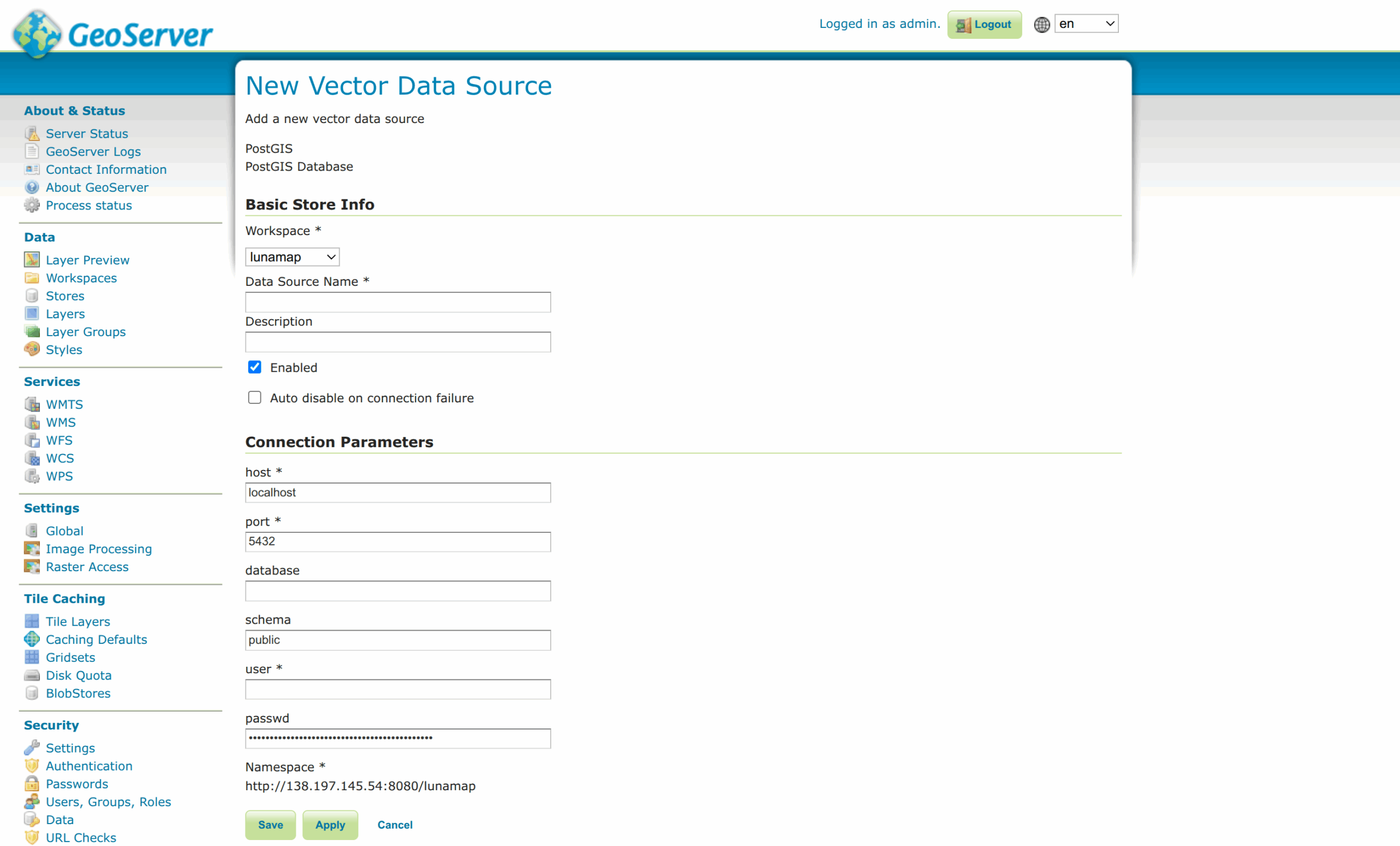
Publish PostGIS Layers in Geoserver
Geoserver, PostGIS
This tutorial explains how to publish PostGIS layers in Geoserver. It is important to note that when creating a PostGIS store, it is created for the entire schema. If multiple layers are to be shared from a single schema, one only needs to create a single store pointing to the schema. If, however, one needs…
-

Publish Shapefiles in Geoserver
Geoserver
Geoserver can also be used to publish shapefiles, which is best done when the layer itself will not change over time. The process to share a shapefile is similar to sharing a PostGIS layer in that one has to (1) create a store and (2) publish a layer from the store. The only difference is…
-

Publish Geopackage Layers in Geoserver
Geoserver
Publishing layers from a Geopackage is very similar to publishing from a PostGIS store because one can publish multiple layers from a single Geopackage. Part 1: Create a Geopackage Store 1. In Geoserver, click on Data > Stores. 2. Click Add new Store at the top of the page. 3. Under Vector Data Sources, click Geopackage. 4. On the…
-
Style Vector Layers in Geoserver
Geoserver
This tutorial details how to style vector layers in Geoserver. Geoserver and QGIS read and write a common style format called Styled Layer Descriptor (SLD) which are used to style layers for Web Map Services (WMS). Follow these steps to export an SLD from QGIS and import it into Geoserver. 1. In QGIS, load the…
How can we help?
Contact us today to schedule a free consultation with a member of our consulting team.