
Tutorials
Learn the basics of QGIS, PostGIS, and Geoserver with our growing list of free tutorials
Filters
-
Private vs Shared Maps in LunaMap
LunaMap
This tutorial explains the difference between private vs shared maps in LunaMap. A map can be set to shared or private, depending on access requirements. A shared map can be viewed by any member of its workspace and modified by the map owner and any Administrator. Private maps, on the other hand, are only accessible…
-
Delete a Map in LunaMap
LunaMap
This tutorial explains how to delete a map in LunaMap from either the map page or from the Map Management page. Method 1: Delete a Map in LunaMap from the Map Page Note: Deleting a map also deletes related items and settings, such as map notes and map-specific layer configurations. Method 2: Delete a Map in…
-
Layer Groups in Geoserver
Geoserver
This tutorial details how to create Layer Groups in Geoserver to publish a group of layers as a single service. A Layer Group can contain both vector and raster data sources and can be accessed via a single WMS request, so it acts like a single layer. 1. Publish and style each layer that will…
-
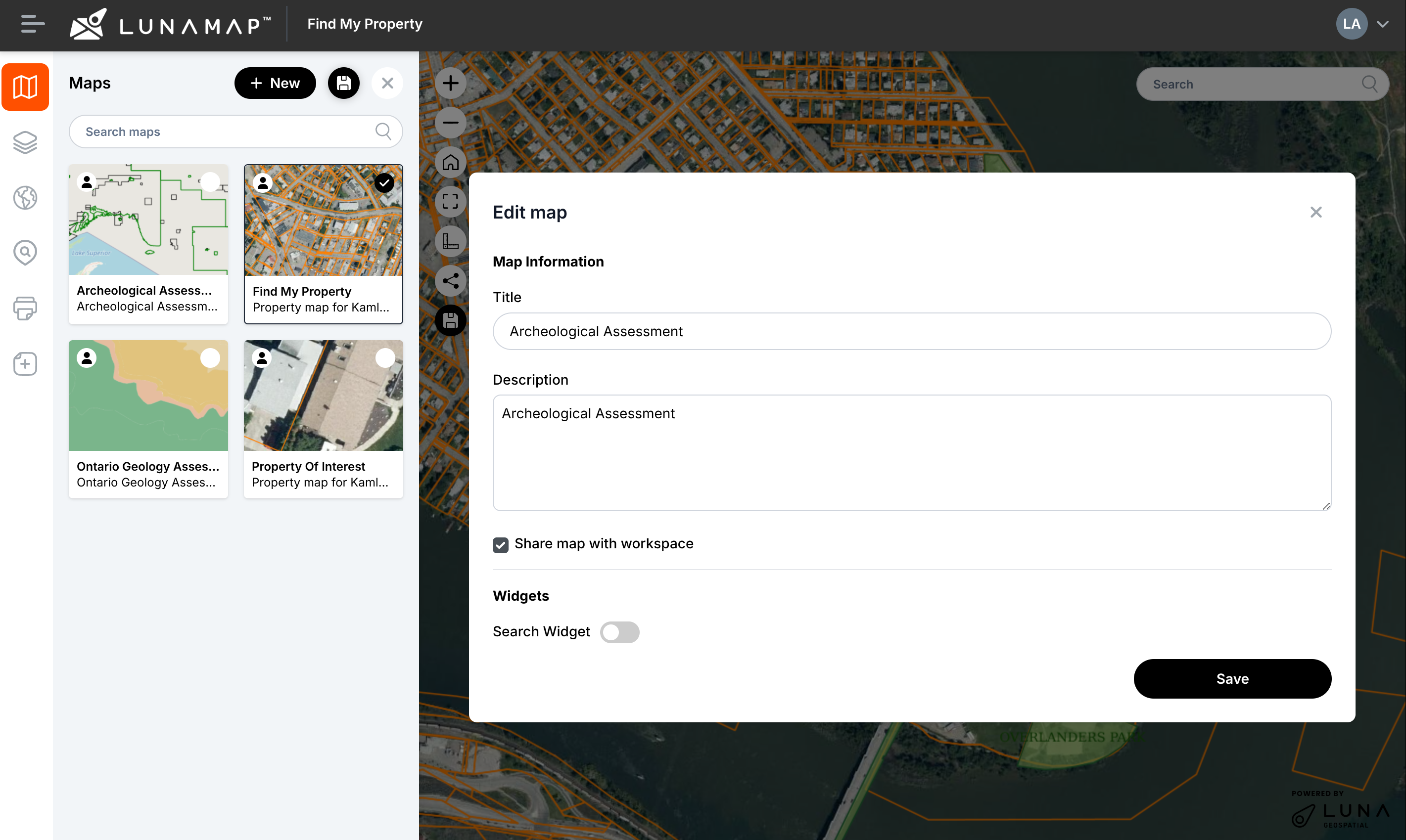
Update Maps in LunaMap
LunaMap
This tutorial explains how to update maps in LunaMap. Every map may contain multiple layers with different settings, such as z-order, opacity, and more. Saving a map will preserve all these configurations so the map is displayed consistently each time it is loaded. Follow these instructions to save changes to a map: IMPORTANTOnly Administrators or…
-

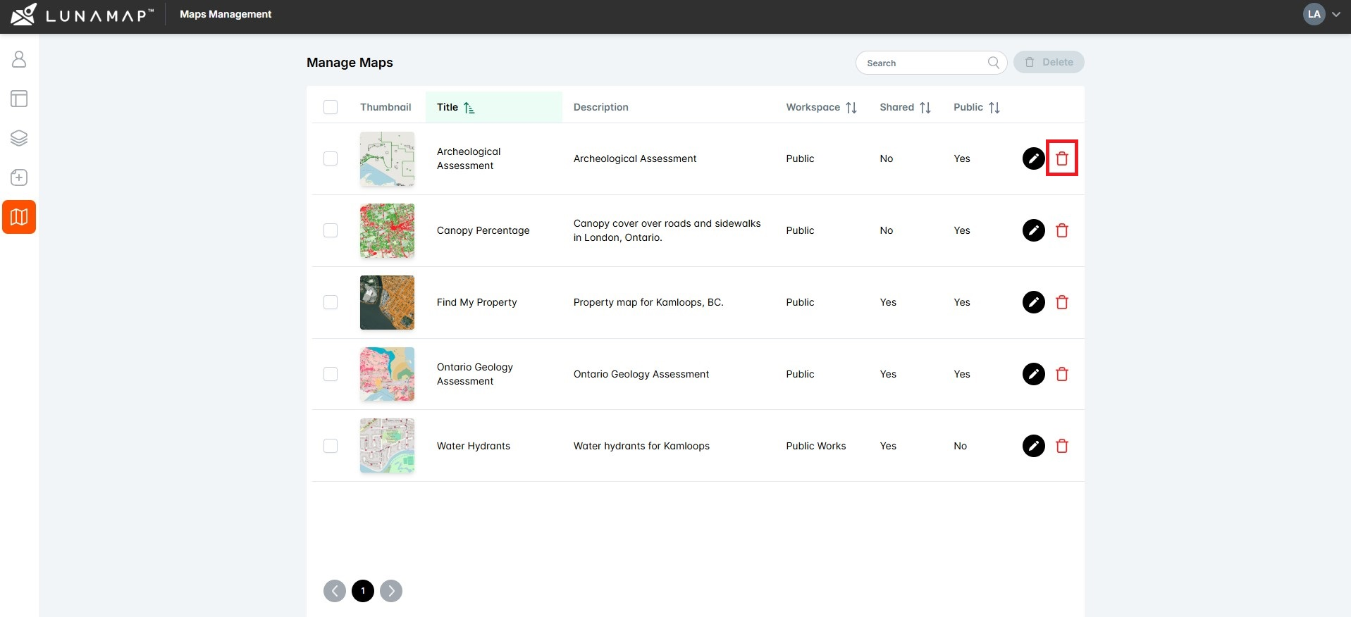
Manage Maps with the Administrator Tools in LunaMap
LunaMap
This tutorial explains how to manage maps with the Administrator Tools in LunaMap, namely how to edit or delete existing maps. The Manage Maps page shows all maps in a table that can be easily sorted and searched. The right column contains two action buttons to either edit or delete a map. Edit Maps Delete…
-
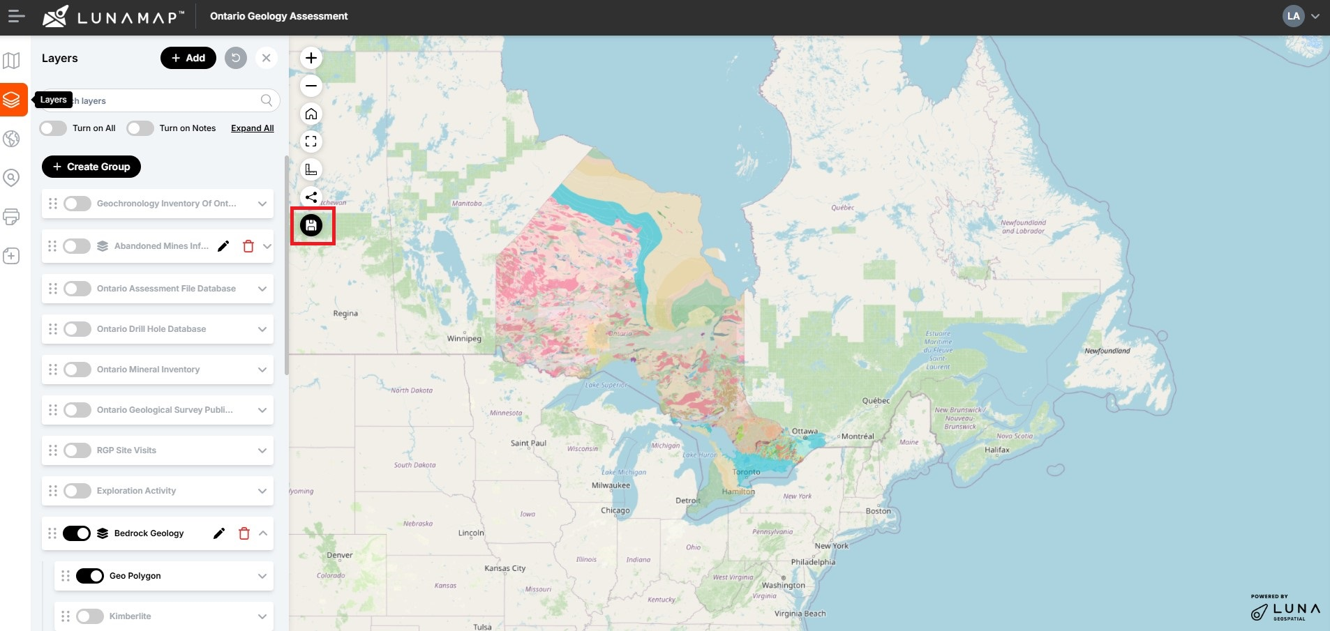
Understanding Layer Management in LunaMap
LunaMap
Summary Understanding layer management in LunaMap is critical for administrators. Layers are either raster and vector data sources and a map can include multiple layers. Each layer in LunaMap can be used across multiple maps and within multiple workspaces. Although most configuration is done by an administrator within the Layer Manager page (e.g. yourdomain.com/layers), within…
-

Publish PostGIS Layers in LunaMap
LunaMap
The following instructions document how to publish PostGIS layers in LunaMap. These instructions assume that you have already published the layer in Geoserver – if needed, see here for instructions on how to publish PostGIS layers in Geoserver. Step 1: Layer Information Step 2: Layer Security The Layer Security section defines the workspaces where the…
-

Publish Raster Layers in LunaMap
LunaMap
This tutorial explains how to publish raster layers in LunaMap is similar to publishing a PostGIS layer except that rasters do not have search and visualization fields defined. Step 1: Layer Information Step 2: Layer Security The Layer Security section defines the workspaces where the PostGIS layers will be available. Step 3: Layer Metadata Step…
-
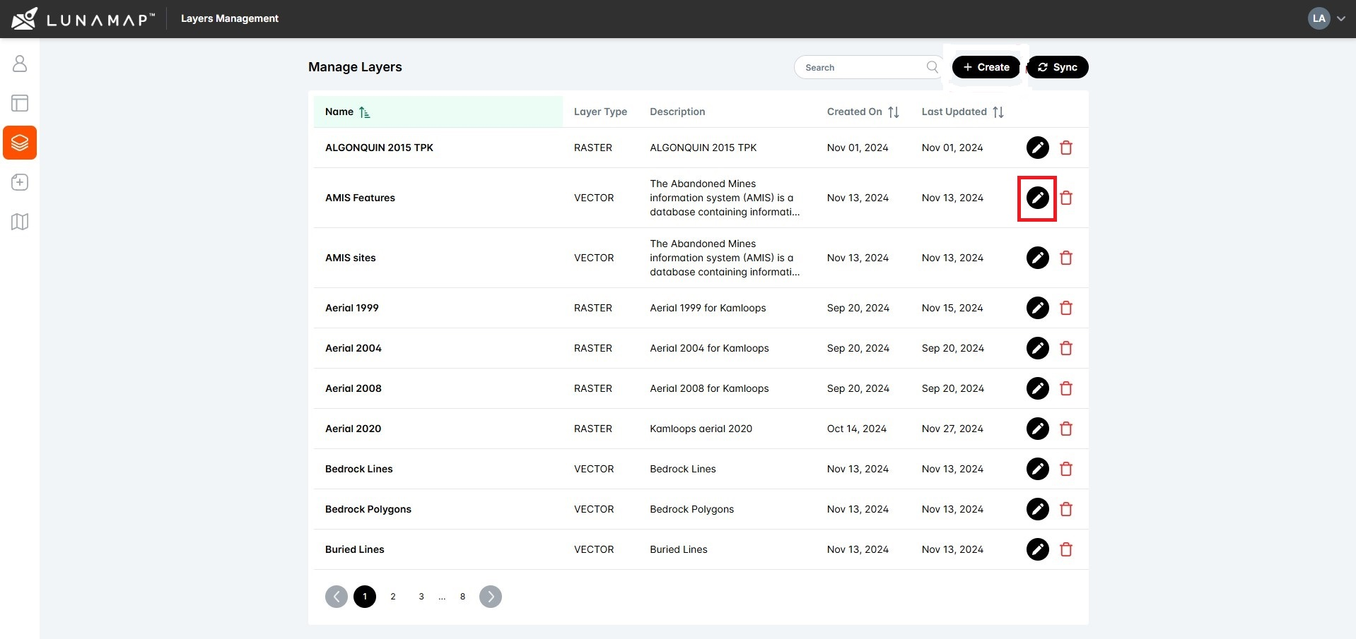
Edit Layers in LunaMap
LunaMap
This tutorial explains how to edit layers in LunaMap, including layer metadata, display properties, and search & zoom parameters. 1. Log into LunaMap as an Administrator. Only Administrators can access the Layer Manager page. 2. Navigate to the Layer Manager at yourdomain.com/layers. 3. In the Layer Manager, click the edit button (pencil icon) next to…
-

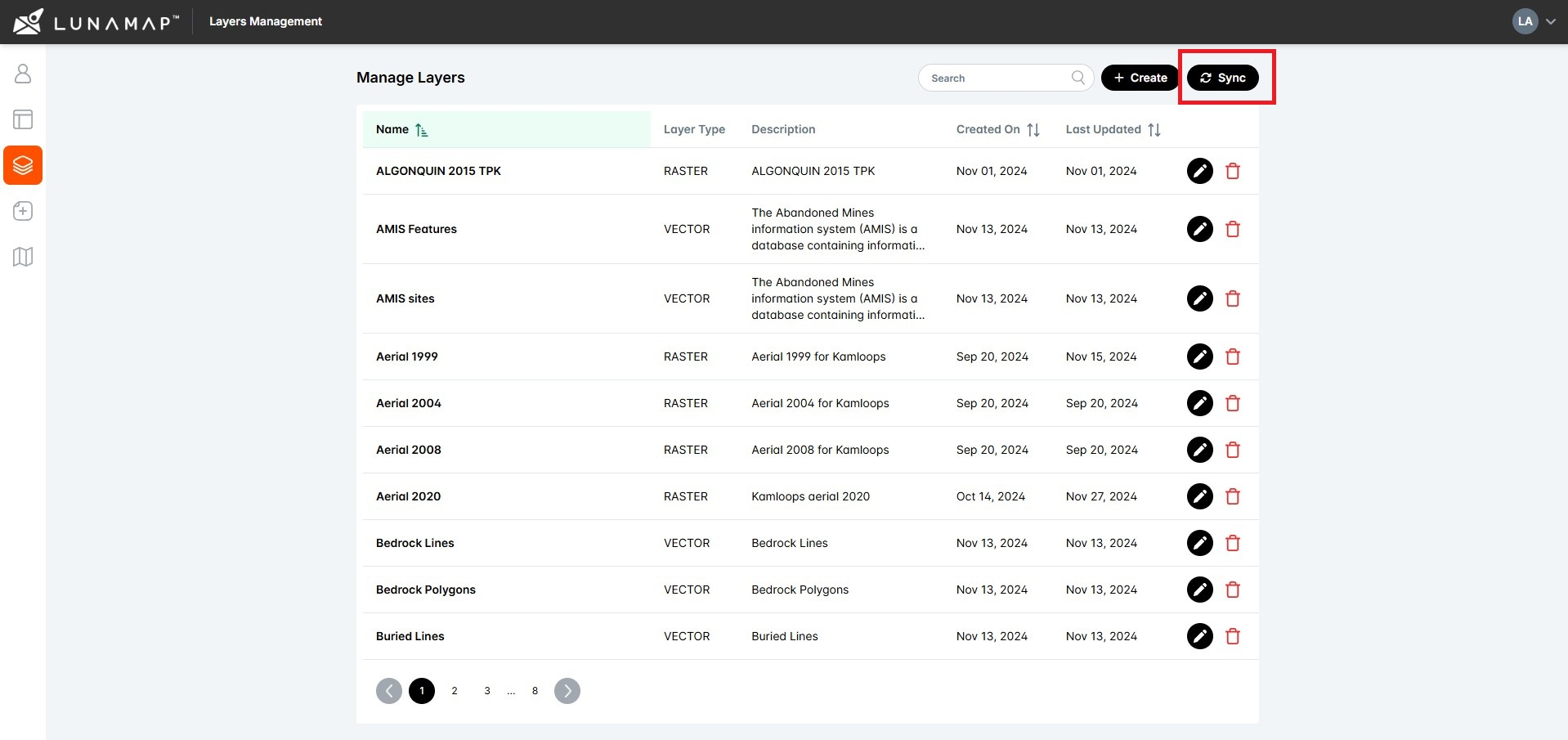
Delete Layers in LunaMap
LunaMap
This tutorial explains how to delete layers in LunaMap using the Layer Manager. IMPORTANTDeleted layers cannot be undeleted. Deleting a layer will remove it from all maps in which it was added.
-

The Layers Panel in LunaMap
LunaMap
The Layers Panel in LunaMap allows users to control how layers are added, organized, and displayed within a map. Using the Layers Panel, users can add or remove layers, adjust layer order, group layers, and access layer tools such as zoom, search, and metadata to manage map content effectively. Open the Layer panel Adding a…
-
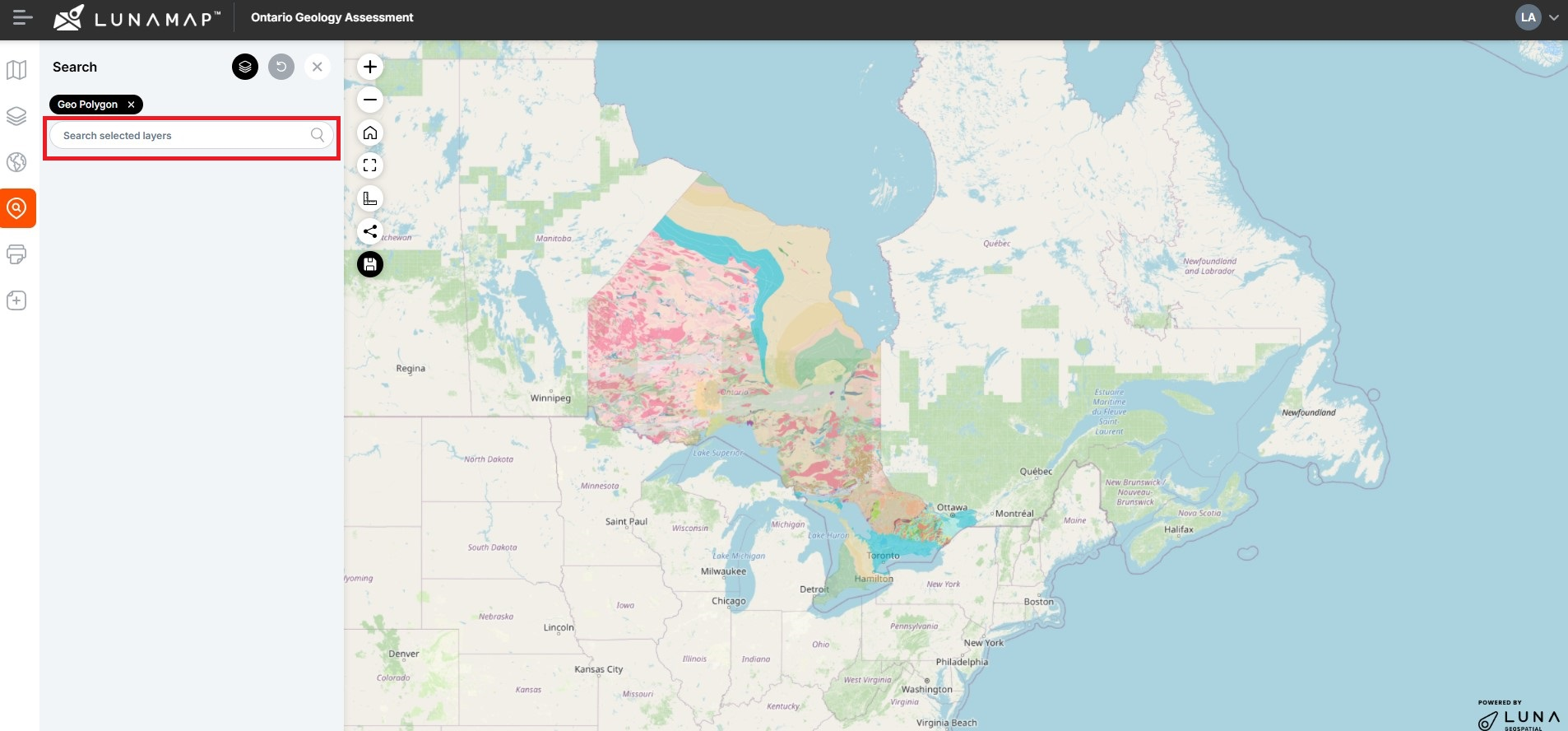
Search and Zoom in LunaMap
LunaMap
This tutorial explains how to search and zoom in LunaMap. The Search and Zoom tool helps locate features based on a search term. The tool will search the selected layer based on the searchable fields defined in the layer manager. For example, if the “address” field is set as searchable in a parcel dataset, the…
How can we help?
Contact us today to schedule a free consultation with a member of our consulting team.