
Tutorials
Learn the basics of QGIS, PostGIS, and Geoserver with our growing list of free tutorials
Filters
-
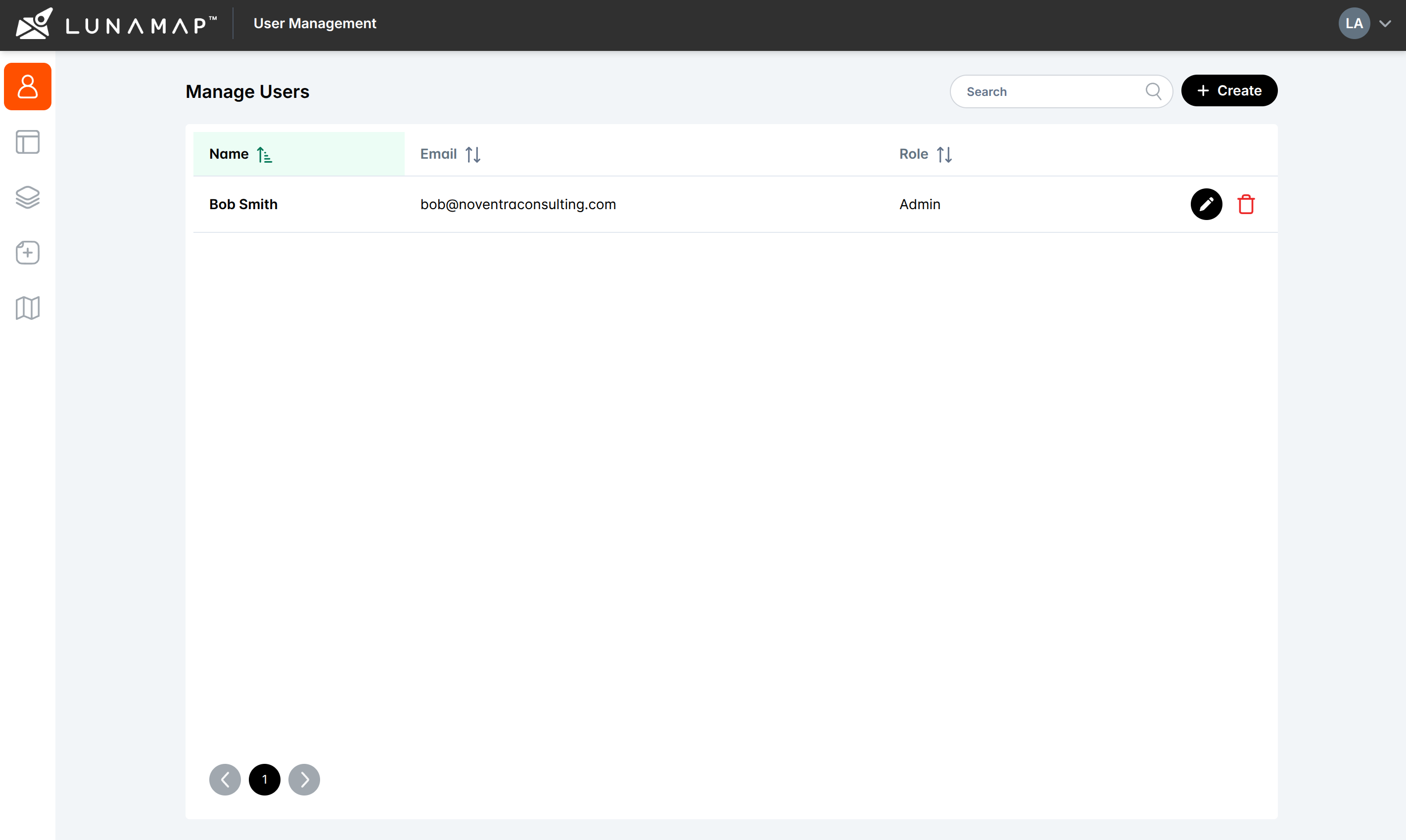
Manage Maps with the Administrator Tools in LunaMap
LunaMap
The Manage Maps section of the administrator tools can be used to edit or delete existing maps. The Manage Maps page shows all maps in a table that can be easily sorted and searched. Editing Maps Deleting Maps
-

Understanding Security and Permissions in Geoserver
Geoserver
Summary This tutorial provides a brief introduction to security and permissions in Geoserver. For more in-depth discussion, consult the Geoserver official documentation here. 1. Users, roles, and groups in Geoserver Geoserver has a granular, role-based permission system to secure workspaces, data, and services. Users, roles, and groups are defined as follows: IMPORTANT: Setting up users, roles,…
-
LunaMap User Roles and Permissions
LunaMap
Overview of User Roles Understanding user roles and permissions is essential to effectively use LunaMap. LunaMap organizes users into four distinct roles, each with specific permissions and capabilities, namely (1) Administrators, (2) Standard Users, (3) Viewers, and (4) Public Users. The following sections provide a detailed explanation of the permissions and capabilities associated with each…
-
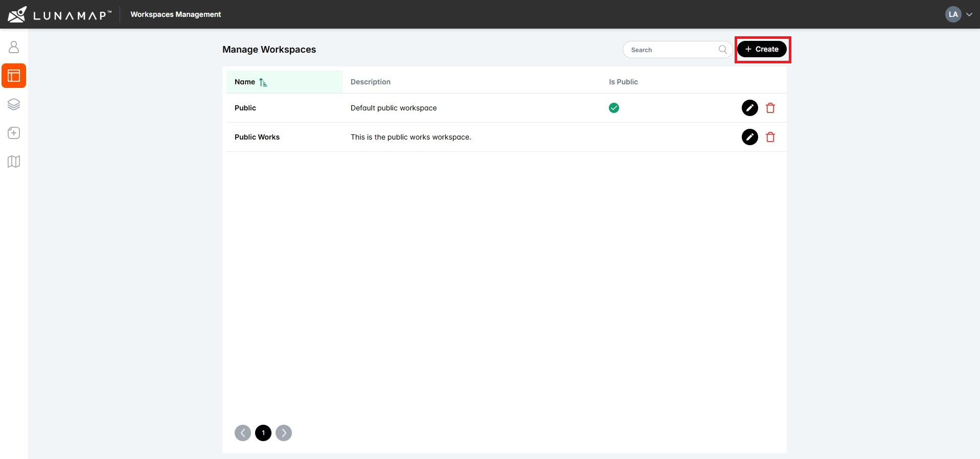
Creating a LunaMap Workspace
LunaMap
Overview Workspaces are the top level of organization within LunaMap such that layers are published to one or more workspaces, maps are created within workspaces, and users are assigned to workspaces. Workspaces can also be private and require authentication or public and available to anyone on the Internet. Creating a Workspace
-
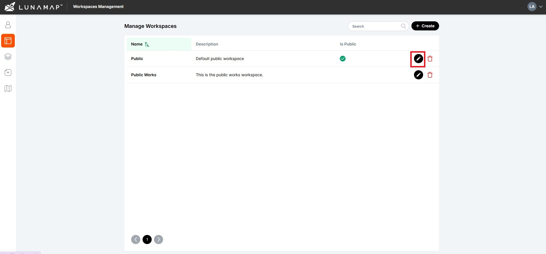
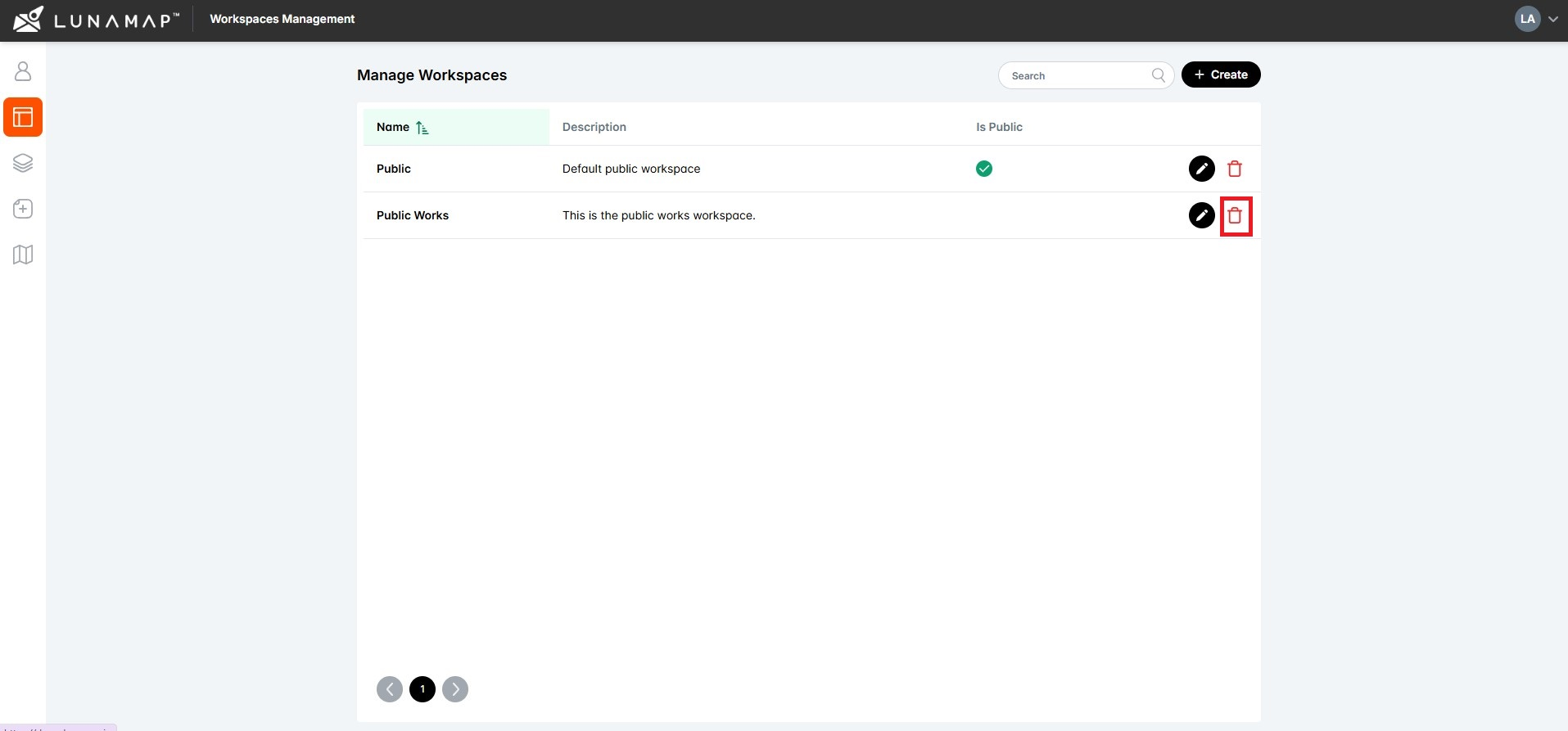
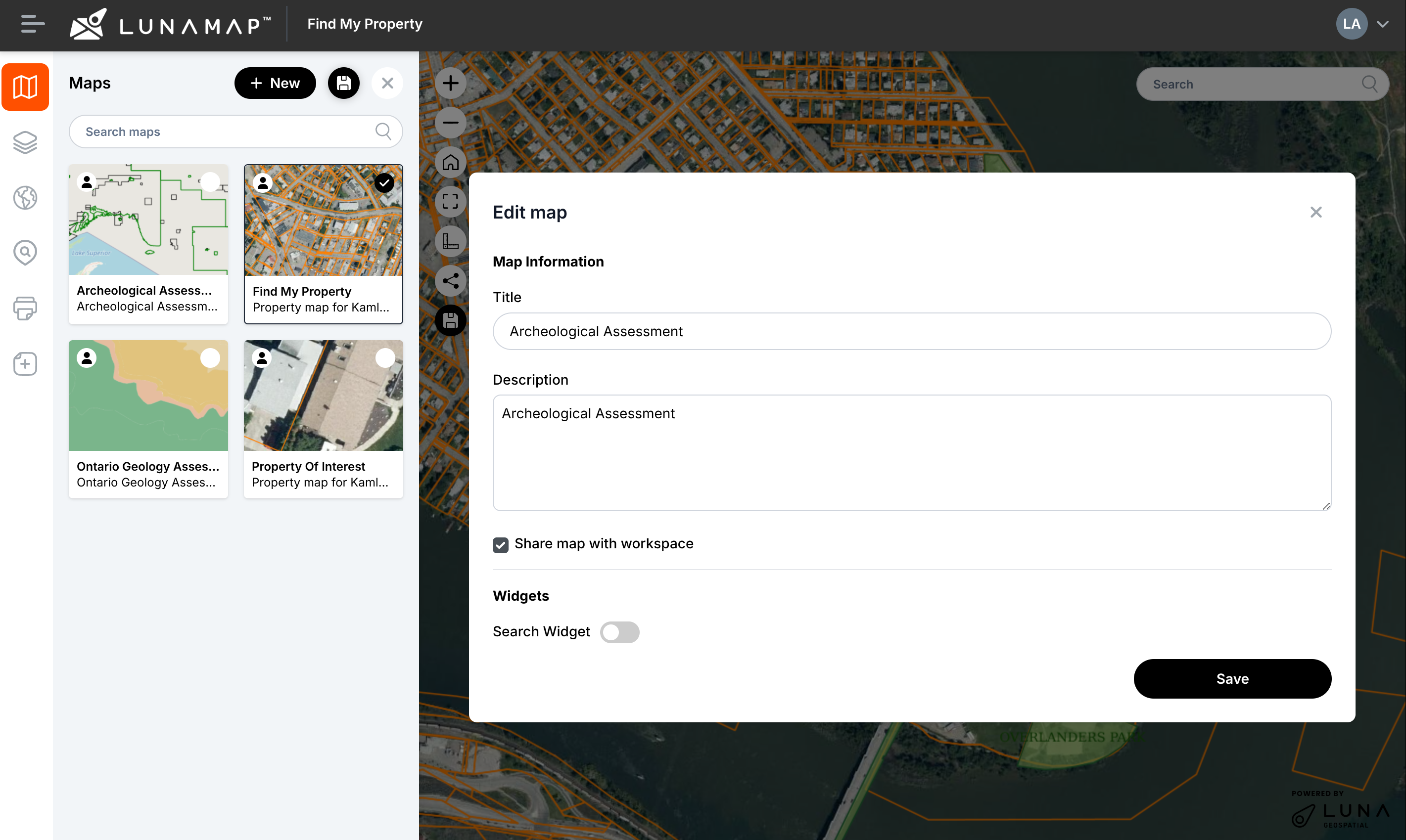
Editing a LunaMap Workspace
LunaMap
Editing workspace information Adding users to the workspace IMPORTANTOnce a user is added to a workspace, they will automatically get access to all maps and layers within it.
-
-

Switching Between LunaMap Workspaces
LunaMap
IMPORTANTIf no maps are yet defined for that workspace, you will see only the base OpenStreetMap layer, and the map section will show no maps.Standard and Viewer users will only see the workspaces to which they have been assigned whereas Administrators will see all available workspaces.
-

Public vs Private LunaMap Workspaces
LunaMap
LunaMap workspaces can be defined as either public or private, depending on access requirements. A public workspace does not require authentication so any online user can access all visible maps and layers. However, public users are read-only so they cannot make modifications to the workspace, maps, or layers. Private workspaces, on the other hand, are…
-
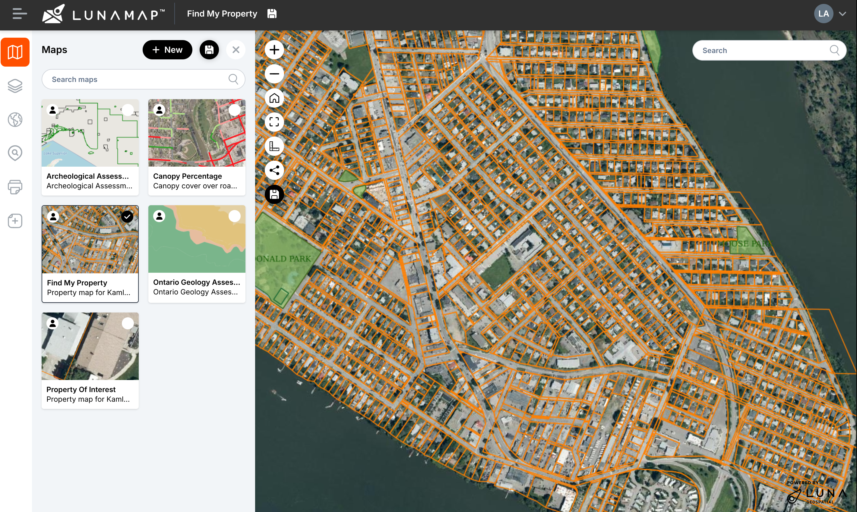
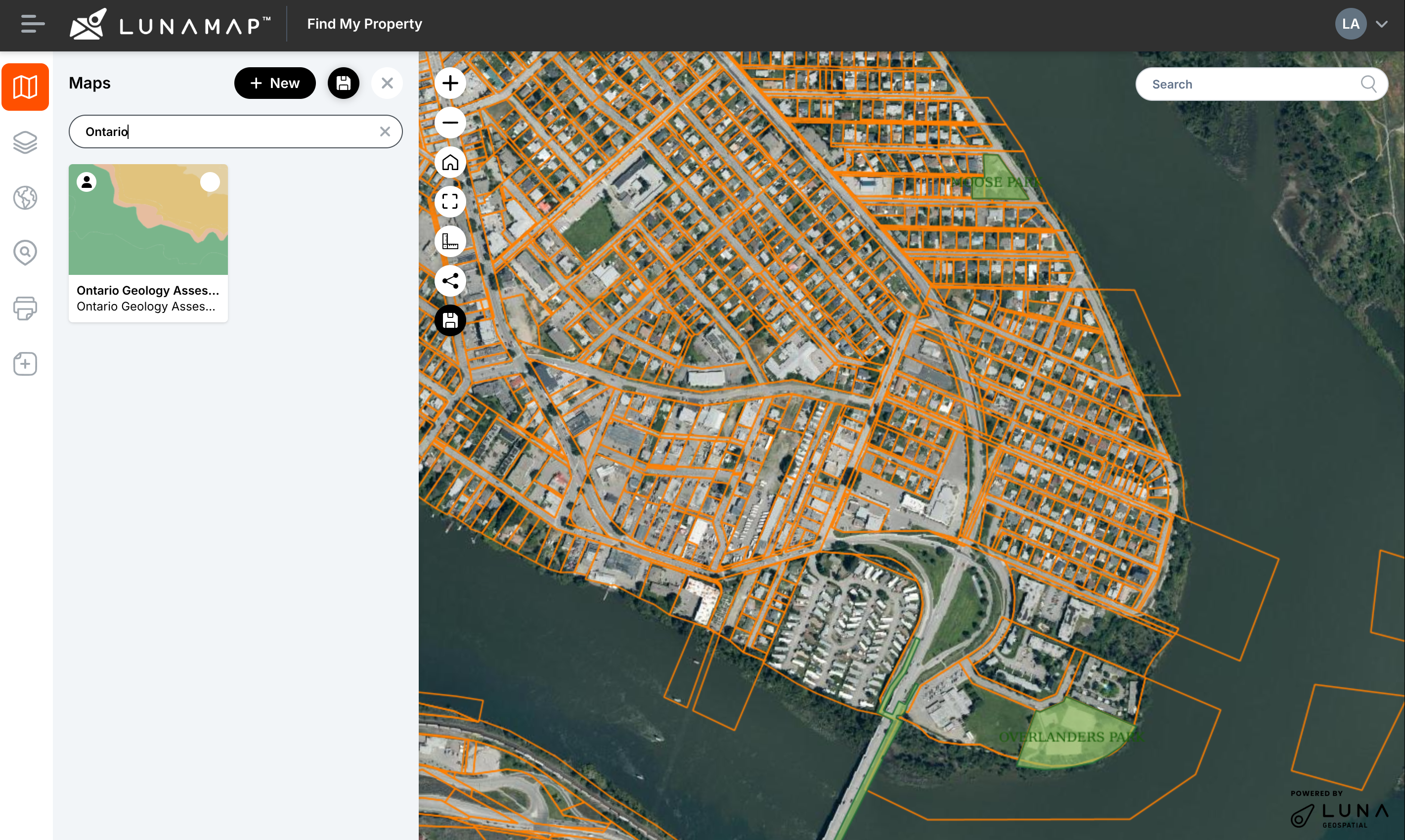
Creating a Map in LunaMap
LunaMap
Maps are created and stored within a workspace using raster and vector layers that were published to that same workspace. While a workspace can contain multiple maps, each map belongs exclusively to one workspace, owned by the map creator, and only accessible to users within its workspace. Switching Maps
-
Private vs Shared Maps in LunaMap
LunaMap
A map can be set to shared or private, depending on access requirements. A shared map can be viewed by any member of its workspace and modified by the map owner and any Administrator. Private maps, on the other hand, are only accessible to the owner of the map or an Administrator. Setting a new…
-
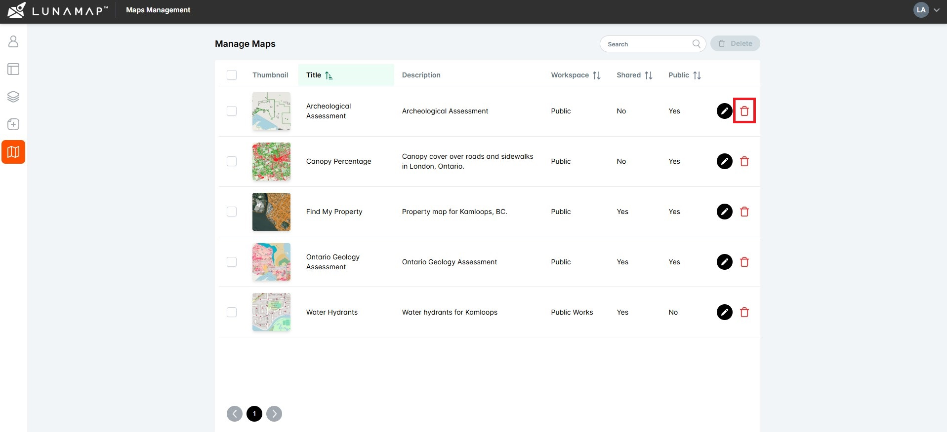
Deleting a Map in LunaMap
LunaMap
Maps can be deleted from either the Map page or from the Map Management page. Deleting a Map from the Map Page Note: Deleting a map also deletes related items and settings, such as map notes and map-specific layer configurations. Deleting a Map from the Map Management page
-
How can we help?
Contact us today to schedule a free consultation with a member of our consulting team.