
Tutorials
Learn the basics of QGIS, PostGIS, and Geoserver with our growing list of free tutorials
Filters
-

Work with GPS Data in QGIS
QGIS, QGIS Basics
This tutorial demonstrates how to work with GPS data in QGIS. GPS data is commonly downloaded in tabular format. In this tutorial, you will learn how to display and save tabular point data as a shapefile in QGIS. What You’ll Learn in this Tutorial Prerequisites 1. Create a New QGIS Project 1. Open QGIS 3.x…
-
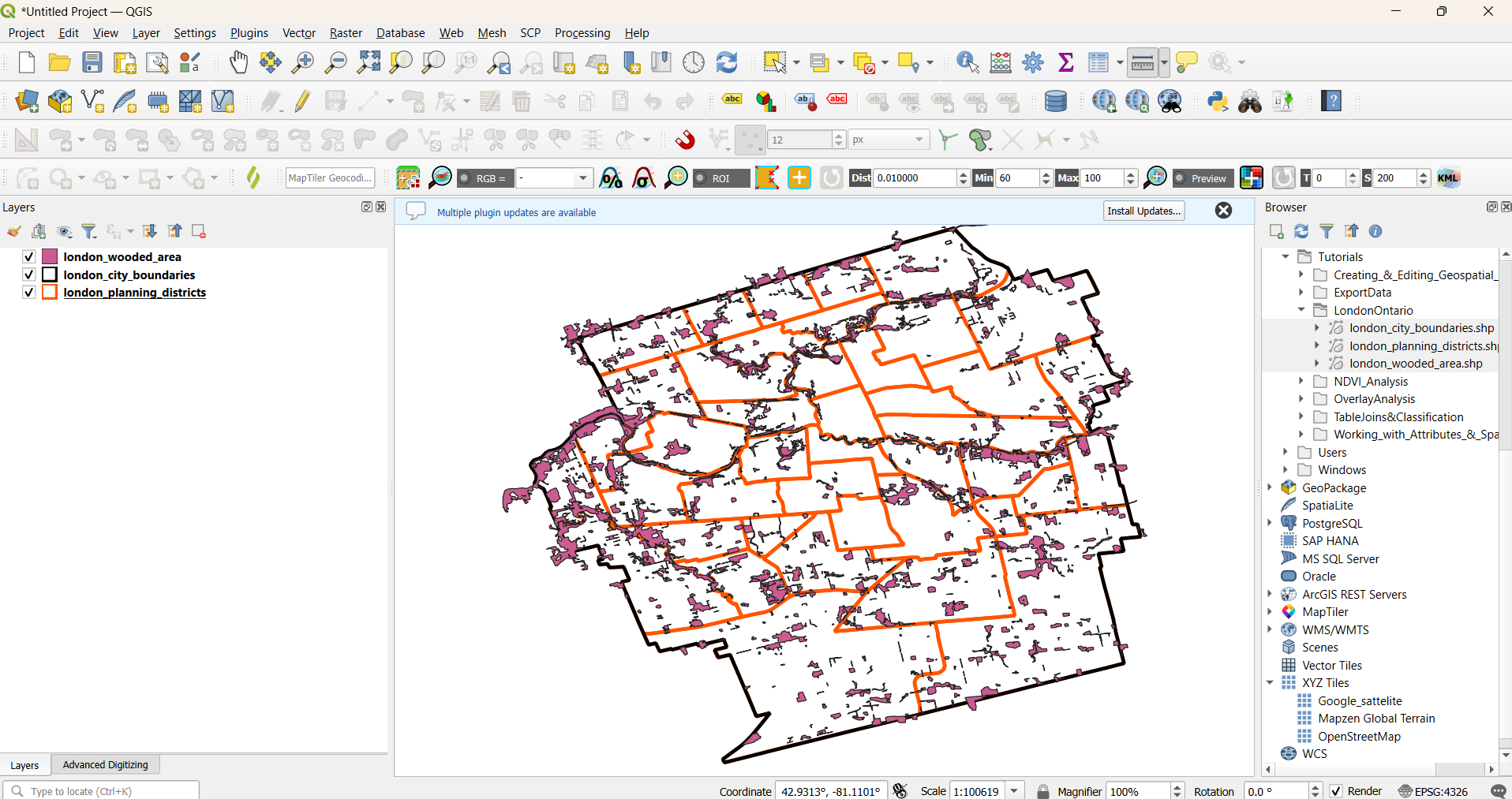
Interact with Geospatial Data in QGIS
QGIS, QGIS Basics
This tutorial demonstrates how to interact with Geospatial Data in QGIS. It provides an example of a geospatial project workflow in QGIS that includes (1) loading geospatial data into a QGIS project, (2) modifying the appearance of map layers appearance and (3) creating and saving a map document output. This will further introduce you to…
-
Create a Spatial Database using PostGIS
PostGIS, PGAdmin4
Step-by-step guide to creating a PostgreSQL database, enabling PostGIS, and building schemas and tables with PGAdmin4.
-

Connect to PostGIS from QGIS
QGIS, PostGIS
This tutorial demonstrates how to connect to PostGIS from QGIS. To connect QGIS to a PostGIS database, use the Browser panel to create a new PostgreSQL connection. You’ll need to provide the host, port, database name, and a QGIS authentication configuration—not basic auth. Authentication settings are stored securely within your QGIS profile and include a…
-

Manage PostGIS Databases in QGIS
QGIS, PostGIS
In this tutorial, you will create the basic structure of an enterprise spatial database. It will have schemas for each major category of data, such as transportation and hydrology. You will also learn how to create, rename, edit, and move tables in the database using the QGIS Browser Panel and DB Manager. What You’ll Learn…
-
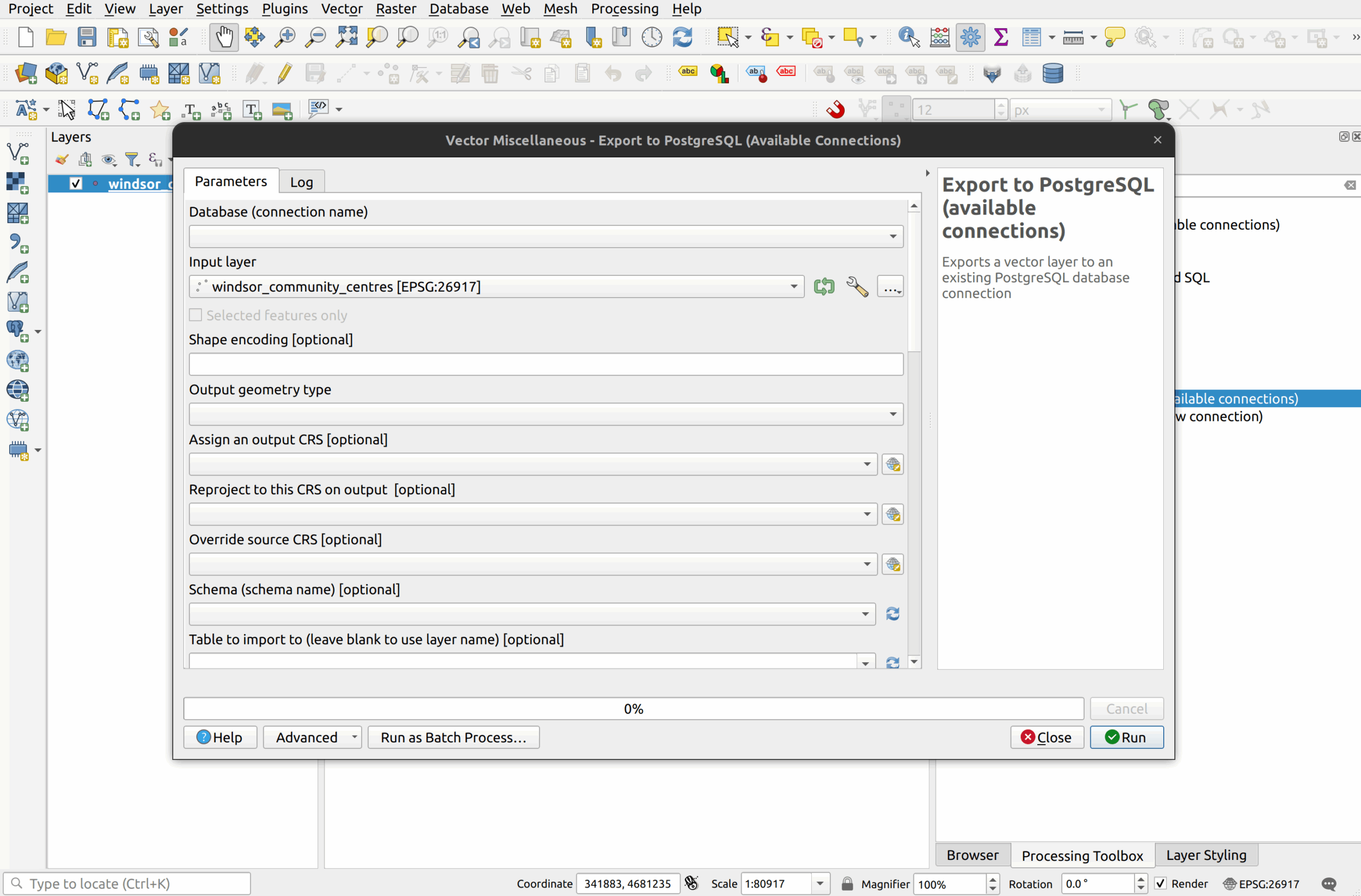
Upload Data to PostGIS using QGIS
PostGIS, QGIS
This tutorial demonstrates how to upload data to PostGIS using QGIS. There are many ways to upload data to a PostgreSQL/PostGIS database, including both GUI and command line tools. QGIS can be used to upload both spatial and non-spatial data into PostgreSQL/PostGIS. In QGIS, there are at least five ways to load data into a…
-
An Overview of the QGIS Interface
QGIS Basics, QGIS
This tutorial will provide an introduction to the QGIS interface and how to interact with it. You will load some demo data into the QGIS interface and
-

Manage QGIS Symbology in PostGIS
QGIS, PostGIS
This tutorial demonstrates how to manage QGIS symbology in PostGIS. QGIS layer symbology can be saved into a PostgreSQL/PostGIS database from which the associated layer resides. Whereas projects are stored in individual project tables in each schema, symbologies are stored centrally in a single table that resides in the public schema. The table is called…
-

Using Native QGIS Tools with PostGIS Layers
QGIS, PostGIS
This tutorial reviews the process of using native QGIS tools with PostGIS layers and shows how this functionality can be used in an enterprise environment. What You’ll Learn in this Tutorial Prerequisites Introduction Layers loaded from PostgreSQL work exactly the same as layers that are loaded from Shapefiles, Geopackages, or any other vector format. The…
-

How to use QGIS User Profiles with Different PostgreSQL Users
QGIS, PostGIS
The tutorial explains how to create multiple QGIS user profiles for different PostgreSQL users. Since QGIS profiles are completely isolated from one another, these profiles are helpful when troubleshooting issues for different users, especially issues related to PostgreSQL. For example, it is possible to create a profile for a read-only user and test their ability…
-

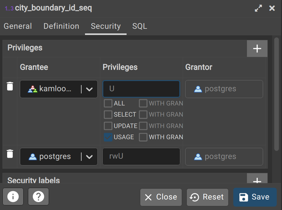
PostgreSQL Permissions and Security
QGIS, PostGIS, PGAdmin4
This tutorial provides a brief overview of PostgreSQL permissions and security. Permissions in PostgreSQL are explicitly granted to a group role or login user. By default, PostgreSQL does not grant any permissions to any users on the system, except for Superusers (see next section). There are three types of roles in PostgreSQL. IMPORTANT: Group and…
-

Getting Started with Spatial SQL using PostGIS
PostGIS
This tutorial provides a brief overview of SQL and spatial SQL with PostGIS. It was designed for those who have little or no experience with SQL so it starts with basic queries and progresses to more complex queries that include spatial functions from PostGIS. The tutorial at the end presents a list of questions that…
How can we help?
Contact us today to schedule a free consultation with a member of our consulting team.